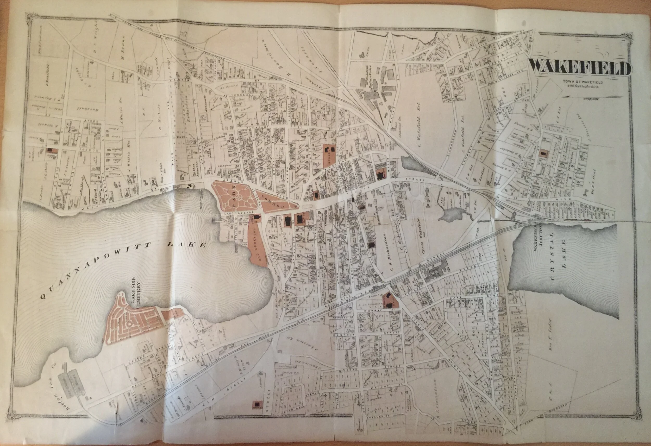
1874 Map of Wakefield, Greenwood, Melrose

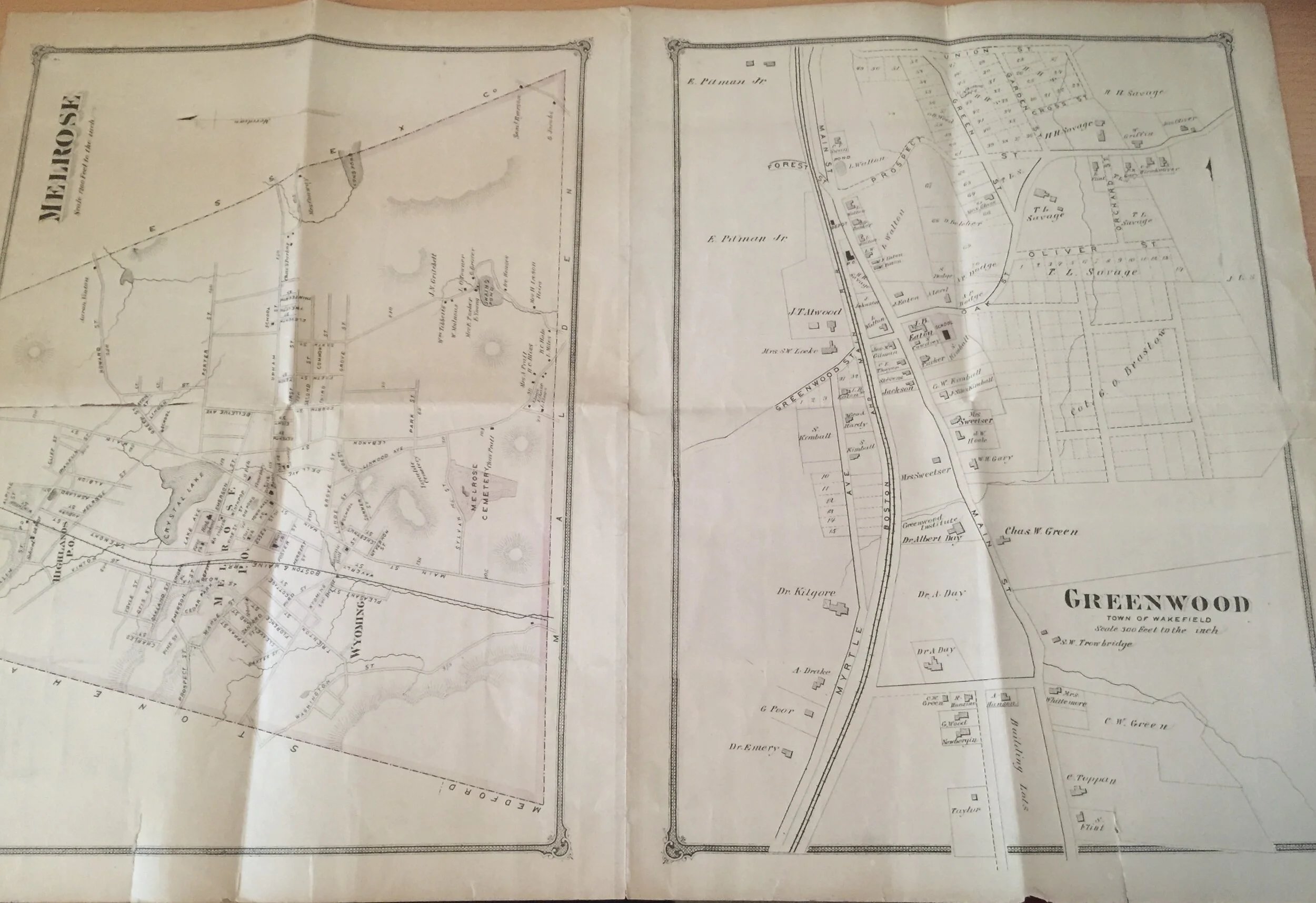
1874 Map of Wakefield, Greenwood, Melrose
This is an authentic 1874 map of Wakefield; the reverse has maps of Greenwood and Melrose, respectively. The map has been folded and is not in perfect shape, with numerous small rips and some discoloration. BUT it is an authentic 1874 map and would look great framed up!
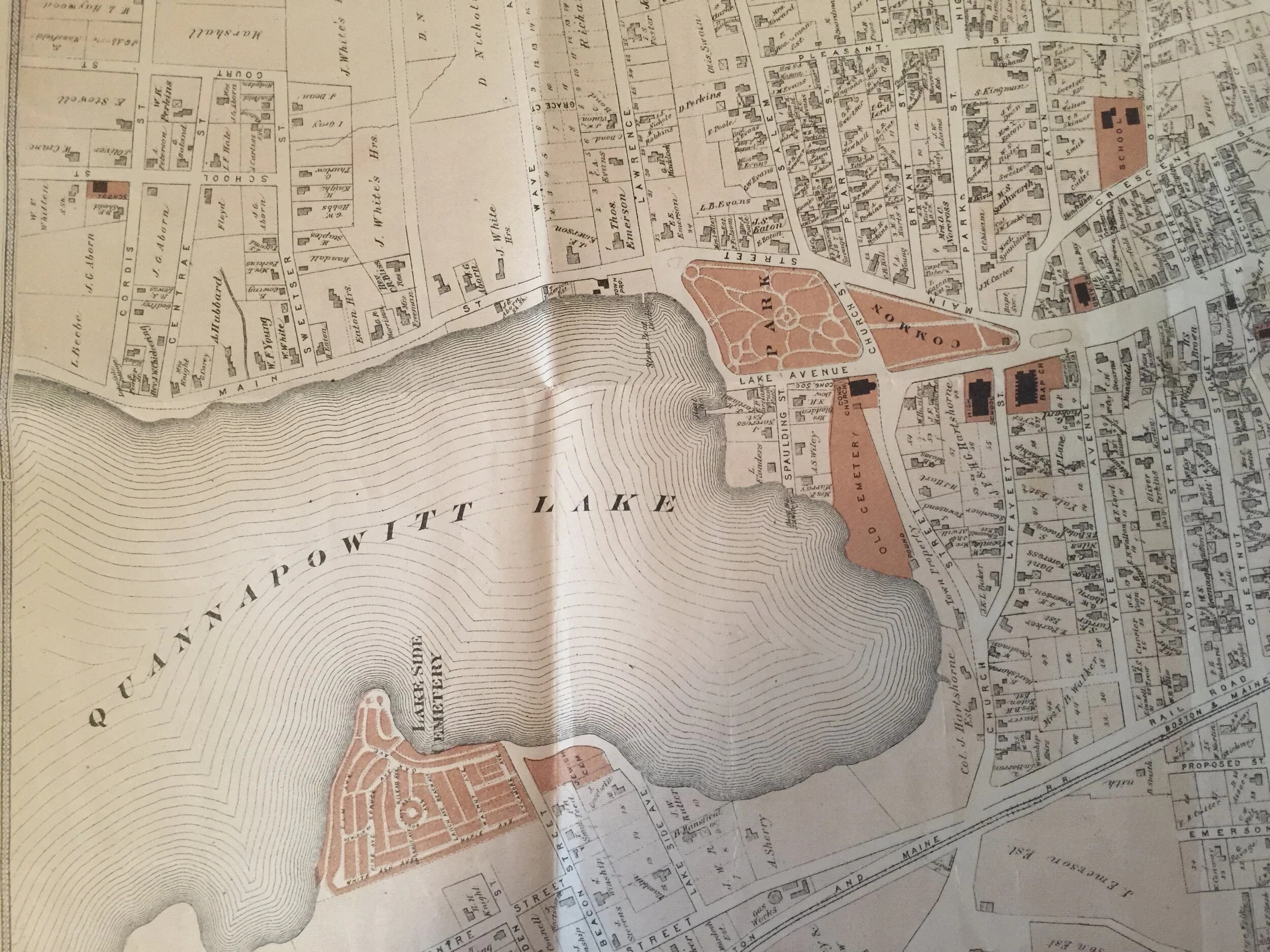
This map was issued soon after Cyrus Wakefield’s death, and his effect on the town is easy to see — just in the sheer amount of real estate owned by his estate! Other landmarks, like the Rockery and the Bandstand, are not in place but you can see other historic sites, like the West Ward School and the Hartshorne House, as well as some of the town’s churches.
This is a treasure — and so hard to come by. Measuring 15.5 x 23.5”, it is eminently framable and would look great on your wall.